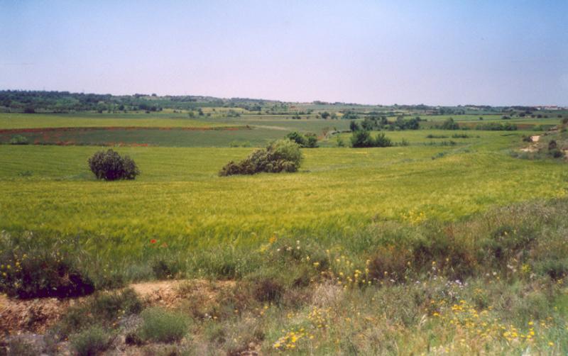
The Urgell is located in the heart of the land to the west, the central basin of Catalonia, with an average height of 350 meters.
The county of Urgell bounded on the north with the Noguera , bordered by the chain saw and the town of Montclar forming a detached islet, surrounded by other counties. To the northeast, Segarra, with its terrain so characteristic tossalenc populated 'almond trees and cereals, which impregnated most of the banks of the rivers' Ondara and Zion, between areas of Tarrega and Agramunt; Garrigues and la Conca of Barbera in the south, which heightened the relief they are strong and the slopes between the serpenteig Corb river and the vineyards and olive groves. To the west, the plaIn Urgell, watered and prosperous, whose waters come mainly around the area Bellpuig.
It is divided into three subcounties very clearly defined. To the north, the RIBERA DEL SIÓ as a main village with Agramunt. RIBERA d'ONDARA, a landscape Segarrenc with Tarrega, prominent as a center and regional capital, and east, the PLAIN OF URGELL, with Bellpuig as a large population.
The Sió is the only that retains its basin well-defined and drawn since it born in the highlands of La Segarra, until dies in the river Segre, close to Balaguer.
The river forms an important part of the habitat and landscape of this part Urgell, which has Agramunt as a core.
Throughout its way join the gardens of the towns and entangled numerous canals that carry water to growing areas. You can also see the remains of mills which provided services to the people, taking advantage of the strength of the current of the river. Remember that before, in the small rivers there were barbel, eels, water birds and some otters.