Route distance: 43,700 km on foot (- 6,850 Km from Rocallaura)
Estimated time: 9 h 52’ on foot
Maximum height: 863 m on foot
Minimal height: 304 m on foot
Accumulated difference: 2.469 m on foot (raise: +1.157m; decrease: -1.312m)
Distance Comaverd variant: 6.850 km
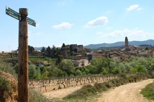
We leave Vallbona along carrer Major towards the road or suburb to Tallat where we take the slightly upwards path with lots of loose stones. We continue flat until we link up with the rural trail of Rocafort de Vallbona to Belltall. We go up a bit along the highest part of Sierra Senadelles, among pine and oak woods and fields of cereals for about 3 kilometres.
From this point we go down until we cross the Maldanell Stream where we climb to the village of Rocallaura.
** If we leave Rocallaura ... we leave along carrer de Catalunya and we take the trail to Belltall that follows the Maldanell Stream. We pass through stretches of pine and oak woods and crops until we reach Belltall, which coincides with the C-14 road. We continue along the road to Forès, smooth between stone walls to the asphalt track along the wind-farm that flattens outat the highest part of the Costes ridge, at the foot of the wind turbines. We continue along the old trail within reach of Belltall to Forès that goes down to the village of Forès. We cross the T-222 road that passes through Pla de la Bassa and continues flat along the road below the village. We follow the asphalt path to Conesa that goes down between woods and crop fields. We continue going down towards Rocafort de Queralt until we reach the centre of the village.
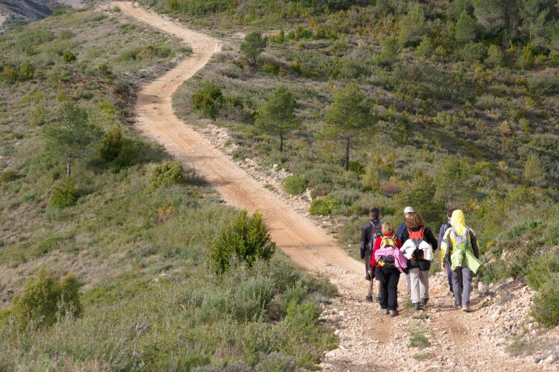
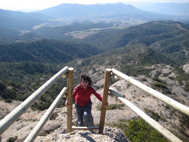
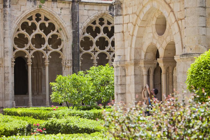
*** If we leave Rocafort de Queralt ... We cross the village to take the road to Montbrió de la Marca with steep downhill’s until the River Vallverd. From here the trail is a steep uphill. The rest is gentler and towards the end we enter fields of crops, pine, oak and holm-oak woods. Finally, we go up until we reach Montbrió de la Marca. We leave along the old stony trail between stone walls. We go down to the cross with Font Voltada. Up hill, through the forest, hard and stony along the buttress of Sierra Comaverd. Further along, after passing the diversion for the MTB bypass, we arrive at Roca del Cogulló, the highest point of the trail with views over the Conca de Barberà and the Camp de Tarragona. Here we have the Grau del Cogulló fitted with hand rails, steps and cords to ensure hikers’ safety. After the Grau the trail slowly goes down between kermes until we reach the urban stretch of the streets that go around the urbanisation of Mas del Plata, where we continue along the forest path to Pont d’Armentera. We cross the village over the Gaià Bridge and we continue along a flat rural trail between vineyards that take us to Santes Creus.
BIKE RIDE
There is provided a variant for cyclists to avoid falling rock Cogulló. First it follows the crest of Comaverd to the Coll de Valls which coincides with the GR7 until shortly after leaving the bottom of the stream of Rupit.
We stretch shabby in BTT:
Beware the final stretch of the descent before of the stream of Rupit.
GPS TRACK DOWNLOAD:
GPS track full route by Sanctuary of Tallat
APPROXIMATE DISTANCES:
BY FOOD:
- Km 6,950 - Rocallaura (Vallbona de les Monges)
- Km 10,900 - Belltall (Passanant i Belltall)
- Km 15,600 - Forès
- Km 20,400 - Rocafort de Queralt
- Km. 22,900 - Montbrió de la Marca (Sarral)
- Km 29,710 - Roca de Cogulló (816 m)
- Km. 34,800 - Urb. Mas del Plata
- Km. 38,600 - Pont d'Armentera
- Km 43,700 - Monastery of Santes Creus (Aiguamúrcia)
MTB:
- Km 6,950 - Rocallaura (Vallbona de les Monges)
- Km 10,900 - Belltall (Passanant i Belltall)
- Km 15,600 - Forès
- Km 20,400 - Rocafort de Queralt
- Km 22,900 - Montbrió de la Marca (Sarral)
- Km 26,580 - Inici variant de BTT del Cogulló
- Km 35,500 - Urb. Mas del Plata (Cabra del Camp)
- Km 39,300 - El Pont d'Armentera
- Km 44,400 - Monestir de Santes Creus (Aiguamúrcia
WATER POINTS:
In the different villages (Rocallaura, Belltall, Forès, Rocafort de Queralt and Montbrió Brand, El Pont d'Armentera and Santes Creus). We also find in the Cave Cativera water near the rock Cogulló.
ACCOMMODATIONS:
Accommodations that relate to those involved with the 6T CARD and you will find in this section. Other accommodation click HERE.
Accommodations in Rocallaura. There is a bar.
- Oca Rocallaura Spa**** - Tel. 973 33 06 32 - http://ocahotels.com/hoteles/espana/lleida/vallbona-de-les-monges/oca-rocallaura/www.ocahotels.com
- Pensión Antiguo Balneario de Rocallaura P * - Tel. 973 33 02 14/ 615 45 56 23 / 619 61 43 27 - www.anticbalnearirocallaura.com
Accommodations in Belltall (a 10 km de Vallbona y a 4 km de Rocallaura). There is a restaurant.
- Hostal Feliuet P ** HT000726. Tel. 977 89 27 05 - www.calfeliuet.com
Accommodations in Forès (to 15.600 km from Vallbona and 9 km from Rocallaura). There is a restaurant.
- Refugio la Abadía (municipal). Tel. 977 89 27 62/696 924 834 - www.fores.cat
Accommodations in Rocafort de Queralt.There are several restaurants and bars.
- Apartaments Turístics Mircla HUTT-00051/52 – Tel. 977 89 80 27 - http://habitatgesturisticsmircla.com/general
Other accommodations in Vallverd (to 8 Km from Rocafort de Queralt).
- Fonda Casa Miret PT-000261 - Tel. 977 898 234 - web
Accommodations in Santes Creus. There are several restaurants and bars
- Alberg Pere el Gran – Tel. 695 18 68 73 - http://www.albergpereelgran.cat/
- Hotel –Restaurant Grau HR** - Tel. 977 63 83 11- www.hostal-grau.com
RECOMENDATIONS:
- This route is apt for any participant who is used to hiking as it does not entail any more difficulty than the distance to be covered and moderate gradients.
- The route should be designed, more or less, in stages and taking into account the number of days you have available, your goals and your physical preparation. The route can be done in both directions.
- Cyclists have 4 bypasses that have been planned for the most complicated parts, but they still require a certain amount of effort and physical preparation.
- Saddlebags are not recommended. If you want you can contract shuttle service luggage and bicycles. Drac Actiu: +34 629 213 263.
- You should get weather forecast information.
- You should take enough eater for the route and drink regularly.
- You should usesun cream.
- You should book accommodation.
- There are many villages with no shops, restaurants......to have a snack.
- Many establishments are closed on Mondays.
- Many establishments do not accept credit cards. There are cash machines in: El Pla de Santa Maria, Montblanc, l'Espluga de Francolíand in Pont d'Armentera.
- The itinerary is signposted with the characteristic GR white and red signs, with directional post that are very clearly identified that, moreover, give information about the place and the altitude.
- You should respect the environment and the norms established by Poblet Nature Park and the by the owners of properties that you pass through.
- Emergency telephone number : 112.
- For any suggestions, incidents or anomalies, please contact: info@larutadelcister.info and by phone on: 977 87 12 47.